
Recently, a curious phenomenon could be observed in Kyiv. After a clear frosty day, a cloudy night came… and the very next morning the frost disappeared somewhere — the temperature rose above zero, puddles squelched underfoot, and piles of snow began to melt. Most people did not pay attention to this, because they were already used to the fact that clouds often “work” this way in winter. But why do they keep us warm and why don’t they do it in the summer?
Warmth can be different
We need to start with the fact that we call “warmth” in summer and winter completely different things. In the cold season, temperatures near zero Celsius are a “thaw” or “warming”. If the same temperatures occur at least in May, not to mention June or July, it will be a catastrophic cold snap, a real weather anomaly.
Another significant difference is the heat source. In summer, the Sun warms us mainly because it is above the horizon much longer than below it, and its rays fall to the earth at a high angle, bringing much more energy per unit area. In winter, in our latitudes, the Sun does not rise high above the horizon, and the day is correspondingly twice as short as the night, that is, the sun’s rays simply do not have time to warm the earth’s surface. In such conditions, the Earth becomes an important “heater”. Firstly, radioactive elements decay in its depths, during which heat is released. Passing through the earth’s crust, it warms up the lower layers of the atmosphere. Secondly, until the middle of winter, an important role in the heat balance is also played by how strongly and deeply the soil warms up during the warm season.
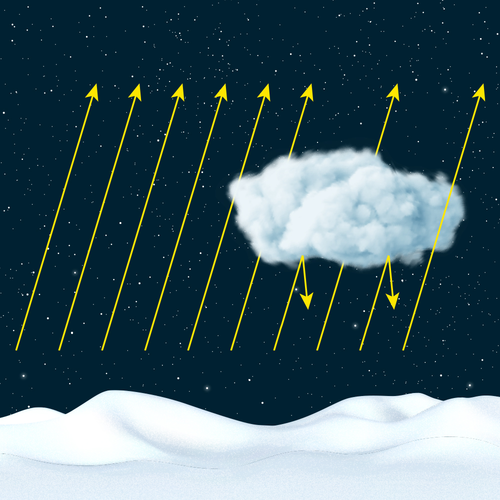
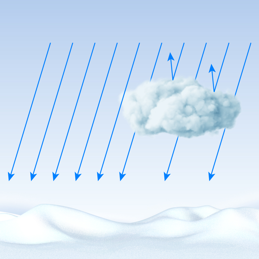
The cooling of the Earth takes place on its night side, which at this particular moment is facing the cold space. It lasts longer in the winter (which means it is more effective) and shorter in the summer. Only clouds and greenhouse gases in the atmosphere, which absorb part of the infrared radiation of the earth’s surface and thereby heat up, can prevent it, and only partially. By the way, if these greenhouse gases did not exist, the average temperature of the surface air layer would be 33° below zero, whereas in fact this figure exceeds 16 degrees with a plus sign.
Heat of condensation
If you wrap a hot kettle or, conversely, ice cream in an ordinary blanket, it is easy to make sure that the blanket does not actually “warm” or “cool” — it slows down the heat exchange of the wrapped body with the environment, allowing it to stay warm or cold longer relative to this very environment. This is not how the “cloud blanket” behaves. Active physical processes are constantly taking place in the clouds, accompanied by the release or absorption of energy.
Clouds are formed when warm air masses collide with colder ones, or when warm, moisture-saturated air rises to a high altitude, where cold constantly reigns. Cooling causes the condensation of water vapor and its transformation into small water droplets or ice crystals. At the same time, even in a very cold environment — for example, in the Earth’s atmosphere at high altitudes — until the steam is exhausted (more precisely, until its pressure drops below partial), the temperature will stay near zero Celsius. According to the laws of heat transfer in such conditions, energy transfer by radiation from a more heated body to a colder one will immediately begin. The latter is often the surface of the Earth, which is also heating up. That is, clouds are able not only to retain heat, but also to generate it!
If the ice crystals in such a cloud become large enough and start falling down, they will carry the heat of condensation with them. On the way to the surface, they will cool down a little, but very often snowflakes are actually warmer than the frozen ground on which they lie. Therefore, during a snowfall, even the strongest frosts weaken.

In summer, snow falls extremely rarely in our latitudes, and the temperature of the earth’s surface does not fall below zero even on the coldest nights. Therefore, the described effects are never observed in the warm season. But even then, it can be noticed that a cloudy night will be warmer than a cloudless one: clouds delay some of the thermal radiation “escaping” into space and return it to earth, preventing it and the surface layer of air from cooling down too much.
Earlier we wrote about interesting optical phenomena related to ice crystals in clouds.
Follow us on Twitter to get the most interesting space news in time
https://twitter.com/ust_magazine
