
Astronauts aboard the International Space Station have taken a series of very spectacular, but at the same time frightening images. They show Hurricane Milton impacting Florida.
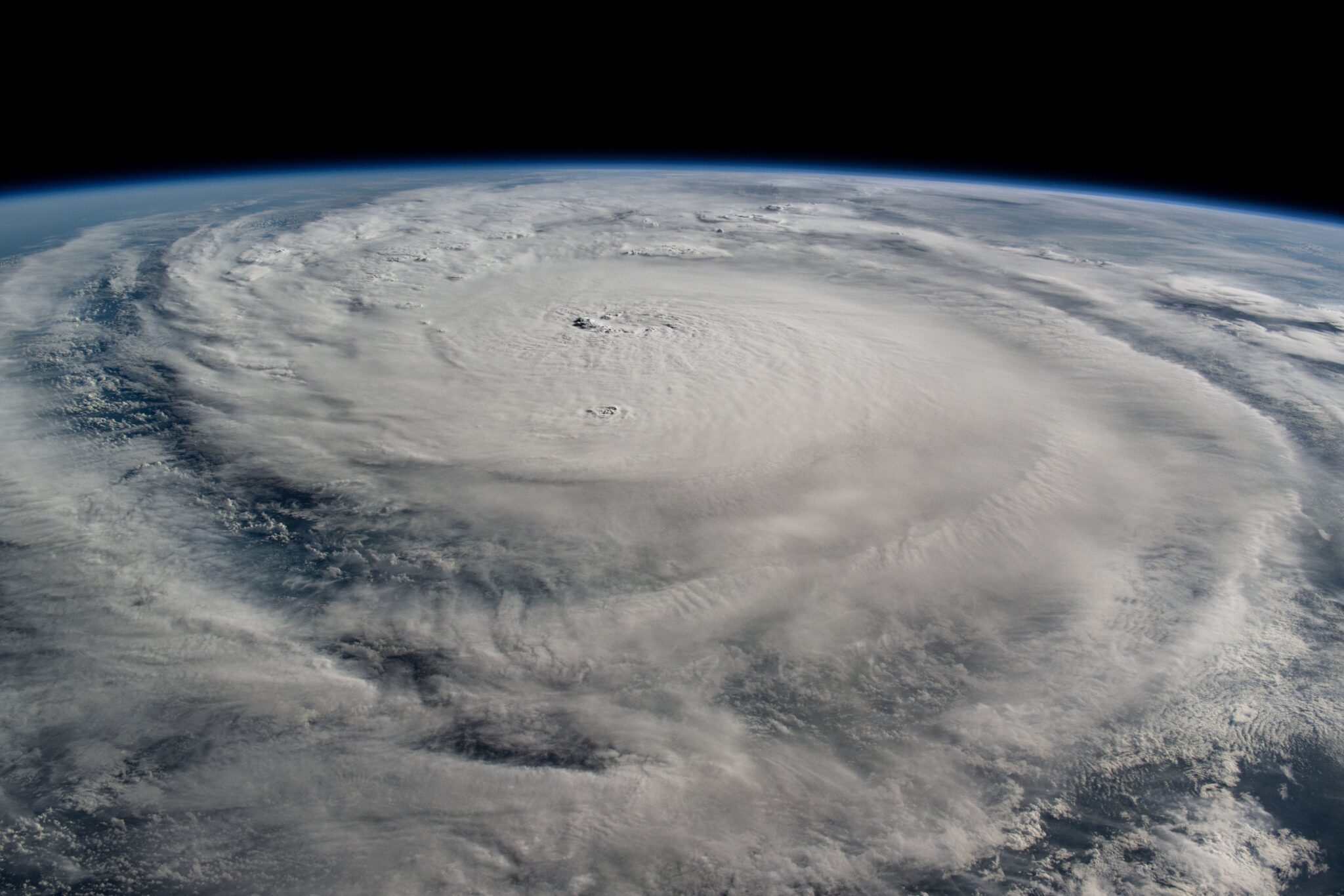
Hurricane Milton formed on October 7. It rapidly gained strength, intensifying to the fifth category. Scientists attribute this to the abnormally high temperature of the upper layer of water in the Gulf of Mexico.
Milton reached the coast of Florida on October 9. Given the power of the hurricane, which has all chances to become one of the strongest in the last hundred years, the authorities had to announce the largest evacuation in the history of the state. More than 5 million people left their homes.
The images taken by the ISS crew show the structure of Milton and its terrifying beauty in great detail. It is already known that it caused severe destruction and human victims.
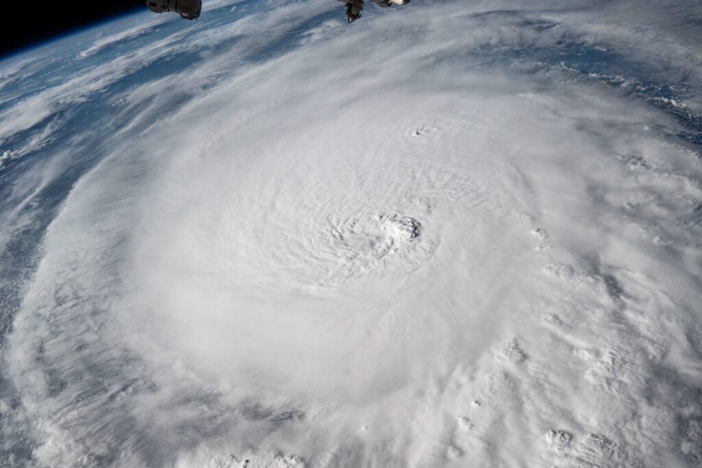
Timelapse flying by Hurricane Milton today about 2 hours ago. Storm looks bigger but less symmetric than yesterday.
1/2000 sec, f8, 14mm, ISO 500, 0.5 sec interval, 30fps pic.twitter.com/XUjQEJPOGg
— Matthew Dominick (@dominickmatthew) October 9, 2024
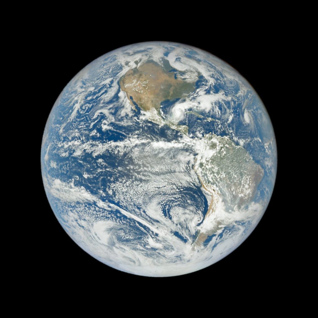
Milton is so large that it can even be seen in a photo taken by the DSCOVR satellite, which is 1.6 million kilometers from Earth.
After Milton reached land, it weakened to a Category 1. The hurricane is currently crossing Florida, moving toward Cape Canaveral. After that, it will head toward the Atlantic Ocean.
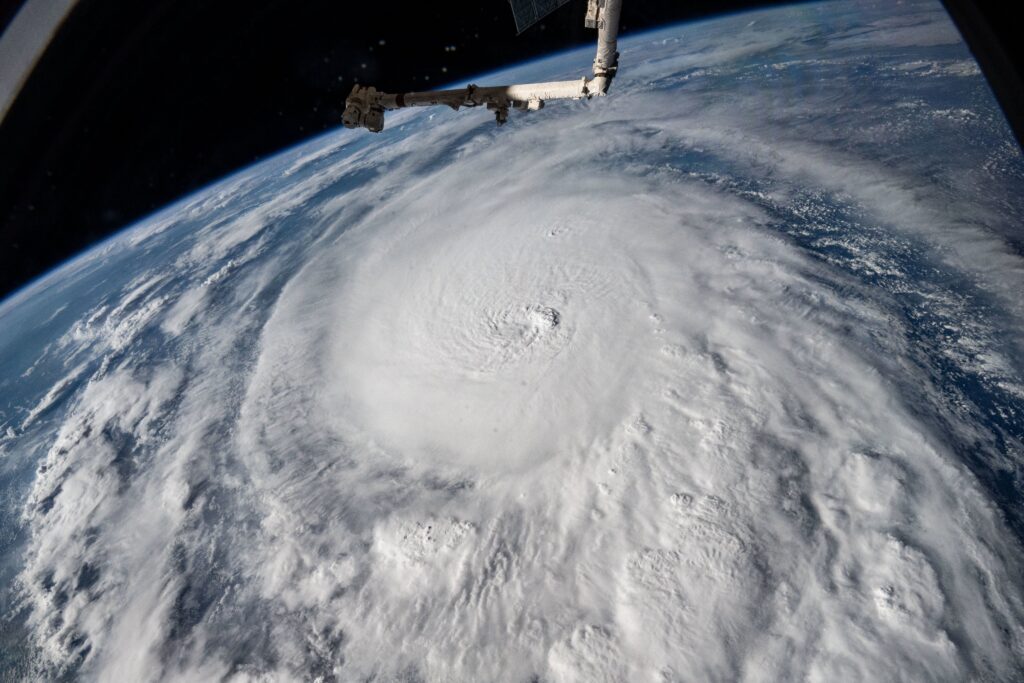
It’s worth noting that the elements had a noticeable impact on NASA’s plans. The Aerospace Administration had to postpone the return to Earth of the Crew-8 expedition astronauts and also postponed the launch of the Europa Clipper mission to October 13.
