
Scientists say that the phenomenon of warm water rising in the Pacific Ocean, known as El Nino, has passed its peak. It affects the global temperature all over the planet. Therefore, there is hope that 2024 may not be as hot as 2023.
El Nino is ending
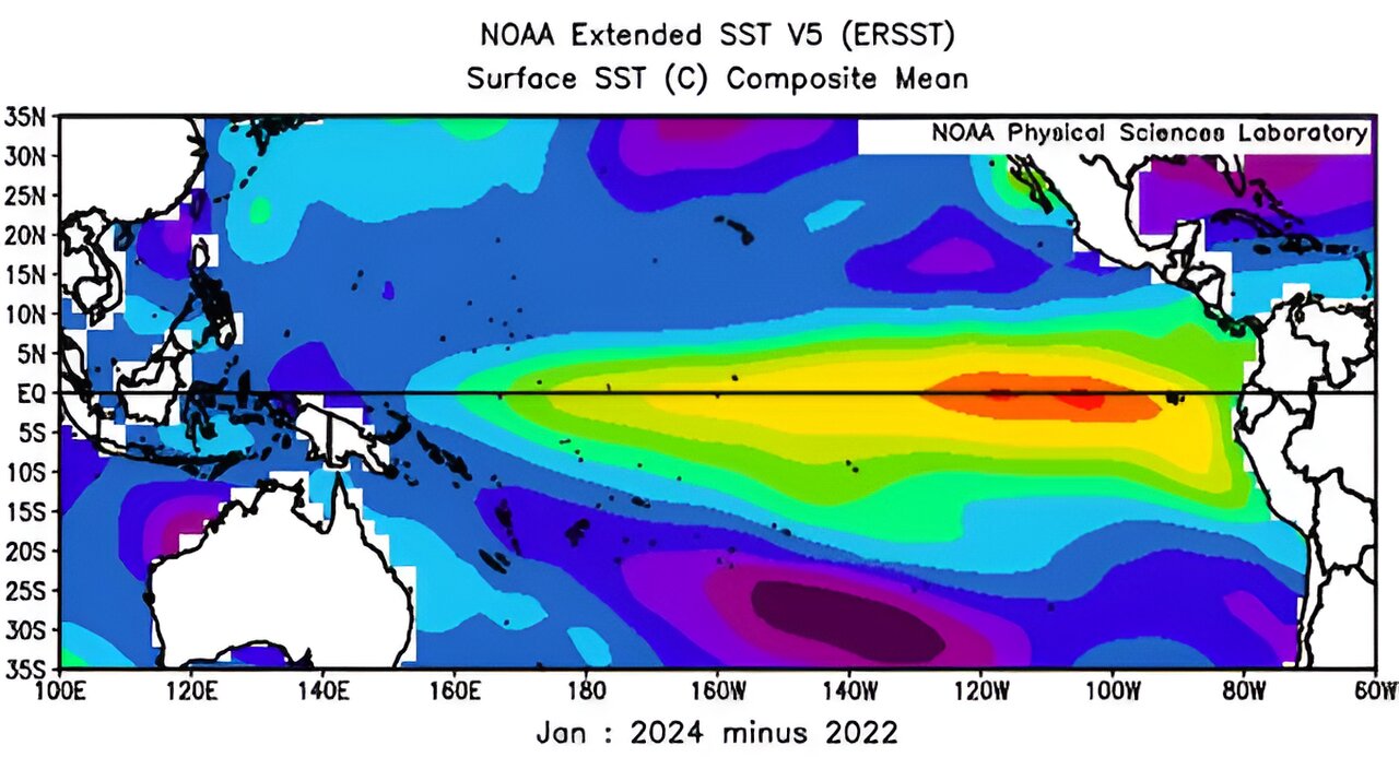
The year 2023 turned out to be the hottest on Earth in the entire history of observations. Not only global warming is responsible for this, but also the climatic phenomenon known as El Nino. However, now scientists claim that it passed its maximum back in December and should end soon.
El Nino is a phenomenon when huge masses of warm water accumulate in the eastern equatorial Pacific Ocean. They come to the surface and begin to heat the atmospheric air, which spreads from there across the planet and causes weather changes everywhere, although it affects both Americas the most.
El Nino repeats every few years and is replaced by the complete opposite — the cold current of La Niña. It makes the climate all over the planet a little cooler. The El Nino of 2023 turned out to be quite protracted, which contributed to an increase in temperatures all over the planet. And although it has already passed the maximum, it may continue until the end of spring, when the winds begin to blow in the right direction.
For some time, according to experts, the water in the Pacific Ocean will be in a neutral position. And this autumn, La Niña may begin. Although scientists can’t say all this for sure, because this cycle is very different from year to year.
Will the end of El Nino have a big impact on the weather in Ukraine?
Although El Nino affects the weather around the world, Ukraine is far enough away from it to feel it only indirectly. This is mainly due to Atlantic cyclones. In North America, they feel like hurricanes. In our country, they manifest themselves as “rains coming from the west.” In winter, these same cyclones bring us relatively warm air with blizzards.
So, with El Nino, Atlantic cyclones become weaker. Warm winds blowing at high altitude simply do not allow them to form. However, this does not mean that during the appearance of a warm current in the Pacific Ocean, the Atlantic is stable. If it is also very hot, then this compensates for the influence of air currents.
In the autumn of 2023, this happened. Atlantic storms were not very strong, but in general they were even more than in previous years. Thus, the spring of 2024 around the globe will still be relatively warm and dry. But in the summer, the air above the Atlantic surface will begin to warm up in the presence of sufficiently cold masses above it.
This will cause the appearance of powerful cyclones, some of them will go to Europe and possibly cause rains in Ukraine. Although we must not forget that we are on the collision line of those air masses that form over the waters of the Atlantic Ocean, and those that are born over the dry massifs of Eurasia.
According to phys.org
Follow us on Twitter to get the most interesting space news in time
https://twitter.comne/ust_magazine
